Pinnacles Christmas Bird Count (CAPI 124)
2025-2026The 2025 count is scheduled for Saturday, January 3, 2026.
Cancelled due to weather
Contact Info:
All count routes
will be coordinated one week or more in advance of the count day. Please
confirm your route with Daniel George.
Daniel George coordinates the count inside the park: dgeorge.nps@gmail.com
Note that there is essentially no cell phone service inside the park, so trying to call Daniel on count day will be hopeless.
To contact the other compiler, Steve Lombardi, email Steve at hotrock175@gmail.com or call cell 925/785-0130.
Submitting Your Count Data: We will provide directions for submitting your data via eBird for compilation. If you are confirmed for a route, expect an email a week or so before the count with more information.
Count Dinner: We will not hold a count dinner this year. We anticipate doing a Zoom recap meeting sometime after the count.
Note: To avoid annoyance, we suggest opening these files in a New Tab (right click on the link and select New Tab).
Note: If any of these files fail to open in your browser, try right-clicking
on the link and saving the file to your hard drive ("Save Target As" in
Internet Explorer or "Save Link As" in Firefox).
The Count Tally Sheet for use in the field is here.
We prefer that you submit your data by eBird.
But if you prefer to keep your data on paper during the count, feel free to use this tally sheet to record your count and your effort.
Audubon Rare Bird Form.
You'll need to fill out this form if you see any rare birds. Any
species not shown on the Tally Sheet is considered rare and requires documentation.
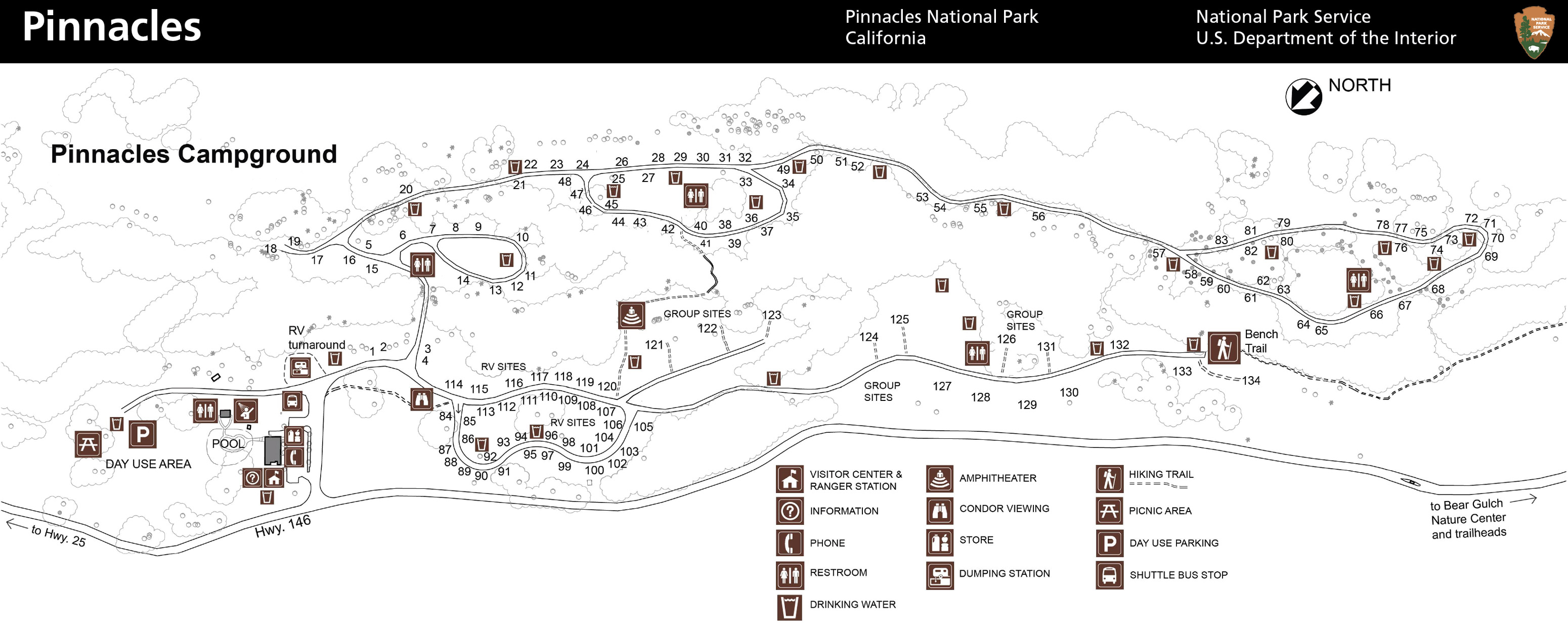
Campground Map: A detailed map of the campground and eastern entrance visitors center.
Inside-the-Park Count Routes: The NPS park map showing CBC count routes inside the park, prepared by Daniel George.
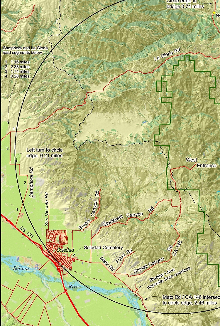
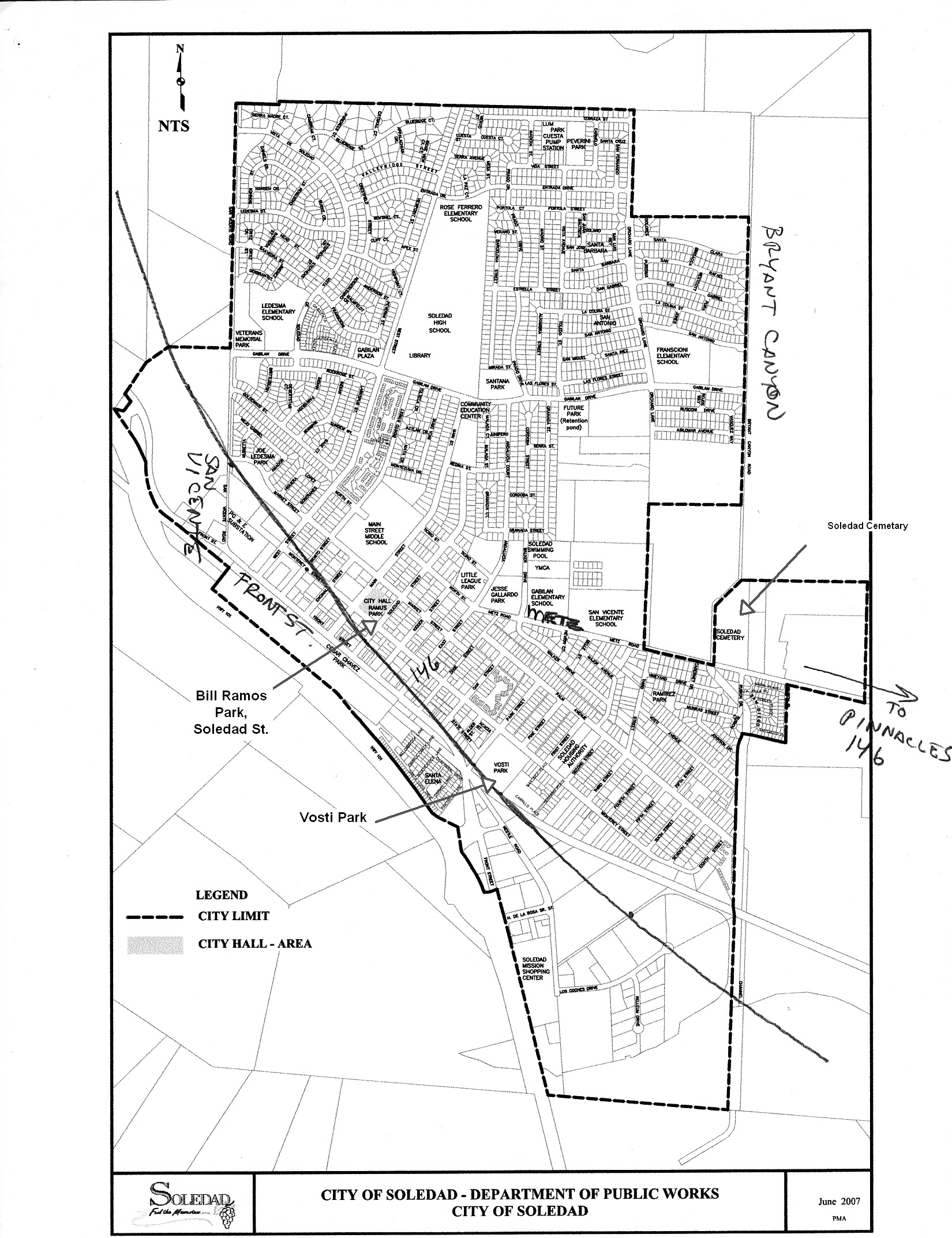
Count circle maps
- To download or view a map of the count circle, which includes roads, terrain, vegetation, and landmarks, click here: PinnCBC_Landsat.pdf. This file is 8.3MB in size, so will take a few minutes to download (but it's worth it). Here is a lower resolution version of the map (2.4MB). Thanks to Rusty Scalf for his hard work in making this map.
- If you don't want to download the big map above, here are two small maps of the partial count circle.
- Count circle, west side (jpeg) (873KB)
- Count circle, west side (pdf) (419KB)
- Count circle, east side (jpeg) (266KB)
- Count circle, east side (pdf) (121KB)
Other Links: Here are some links that you might find helpful.
- The count circle on Google Earth. This kmz file will open Google Earth and overlay the count circle on it. Requires the free Google Earth software.
- A link to the official NPS Pinnacles National Park site.
- A link to the NPS map site for Pinnacles, where you can download several different maps for the park.
- A link to the Christmas bird count site at National Audubon.
- A link to Nature Ali's site for a list of all California CBC's.
Count Results
2012 count results (includes entire count history)
Area count sheet, 2010
Area count sheet 2009