Pinnacles Christmas Bird Count (CAPI 123)
2023-2024
The 2023 count is scheduled for Friday, January 5, 2024.
We did the 2021 count on 1/5/2022. The weather was generally clear and mild. We had adequate coverage on all routes. As has been the case for the past few years, we did not have access to significant bodies of water, so water birds were in short supply.
This is the first year we did the count using exclusively eBird as the data submission tool. This resulted in our number of checklists growing from 12 (paper) to 87 (eBird). It also raised questions about how to report effort, especially driving effort (using multiple stationary checklists on a driving route tends to understate total hours and mileage); simply take what eBird reports or ask counters to report total hours and mileage as in the past? One solution may be to have driving route leaders create narratives to accompany their eBird lists, including their own sum totals for the day. The eBird Trip Report feature may be a way to both aggregate all driving checklists into one set of sums for species as well as document overall distances and start-stop times. We do need clarity on whether groups will include time for relocating between sites – when not birding along the way.
COUNT RESULTS. After years of drought we were happy to see that most species counts were in the low-normal range. Here are some notables:
Cal Quail: 292, a near low.
Wild Turkey: 115, a near high.
Turkey Vulture: 30, a near high. We adjusted gross numbers to account for multiple parties seeing the same soaring birds simultaneously.
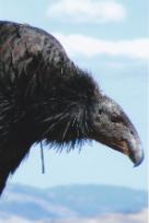
Cal. Condor: 17, as accurately reported by the condor techs in the park (the gross number was 54).
Mourning Dove and Yellow-billed Magpie: In 2013 the numbers of both of these east-side species declined greatly, with MODOs averaging in the teens and YBMA averaging in the 40s for the past few years. This year, we had 18 MODOs and 59 YBMAs.
Acorn Woodpecker numbers have been increasing more or less steadily over the years. We hit a new high of 405 this year.
The two unusual species this year were both seen in the park campground: two Chestnut-backed Chickadees (CBCHs are unusual inside the park) and one White-throated Sparrow (very infrequent in the park).
Contact Info:
All count routes
will be coordinated one week or more in advance of the count day. Please
confirm your route with Daniel George.
Daniel George coordinates the count inside the park: dgeorge.nps@gmail.com
Note that there is essentially no cell phone service inside the park, so trying to call Daniel on count day will be hopeless.
To contact the other compiler, Steve Lombardi, email Steve at hotrock175@gmail.com or call cell 925/785-0130.
Submitting Your Count Data: We will provide directions for submitting your data via eBird for compilation. If you are confirmed for a route, expect an email a week or so before the count with more information.
Count Dinner: We will not hold a count dinner this year. We anticipate doing a Zoom recap meeting sometime after the count.
Note: To avoid annoyance, we suggest opening these files in a New Tab (right click on the link and select New Tab).
Note: If any of these files fail to open in your browser, try right-clicking
on the link and saving the file to your hard drive ("Save Target As" in
Internet Explorer or "Save Link As" in Firefox).
The Count Tally Sheet for use in the field is here.
We prefer that you submit your data by eBird.
But if you prefer to keep your data on paper during the count, feel free to use this tally sheet to record your count and your effort.
Audubon Rare Bird Form.
You'll need to fill out this form if you see any rare birds. Any
species not shown on the Tally Sheet is considered rare and requires documentation.
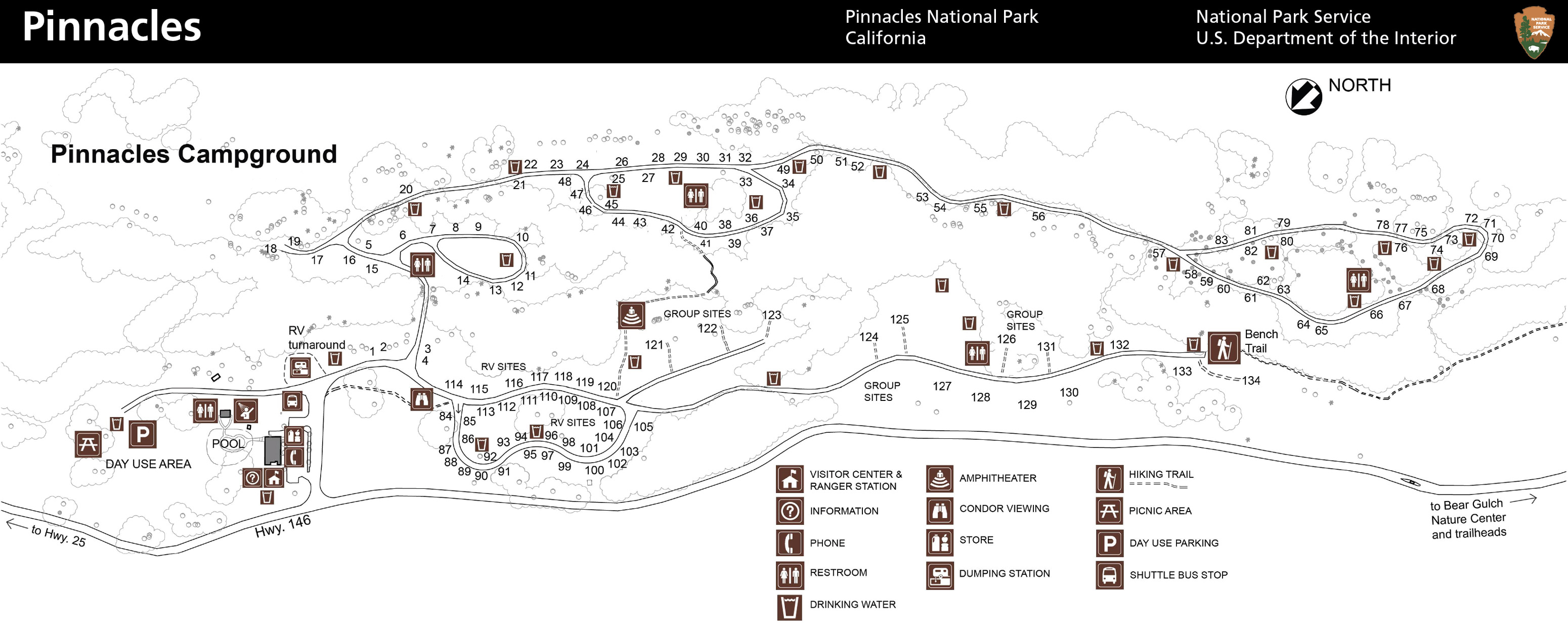
Campground Map: A detailed map of the campground and eastern entrance visitors center.
Inside-the-Park Count Routes: The NPS park map showing CBC count routes inside the park, prepared by Daniel George.
Count circle maps
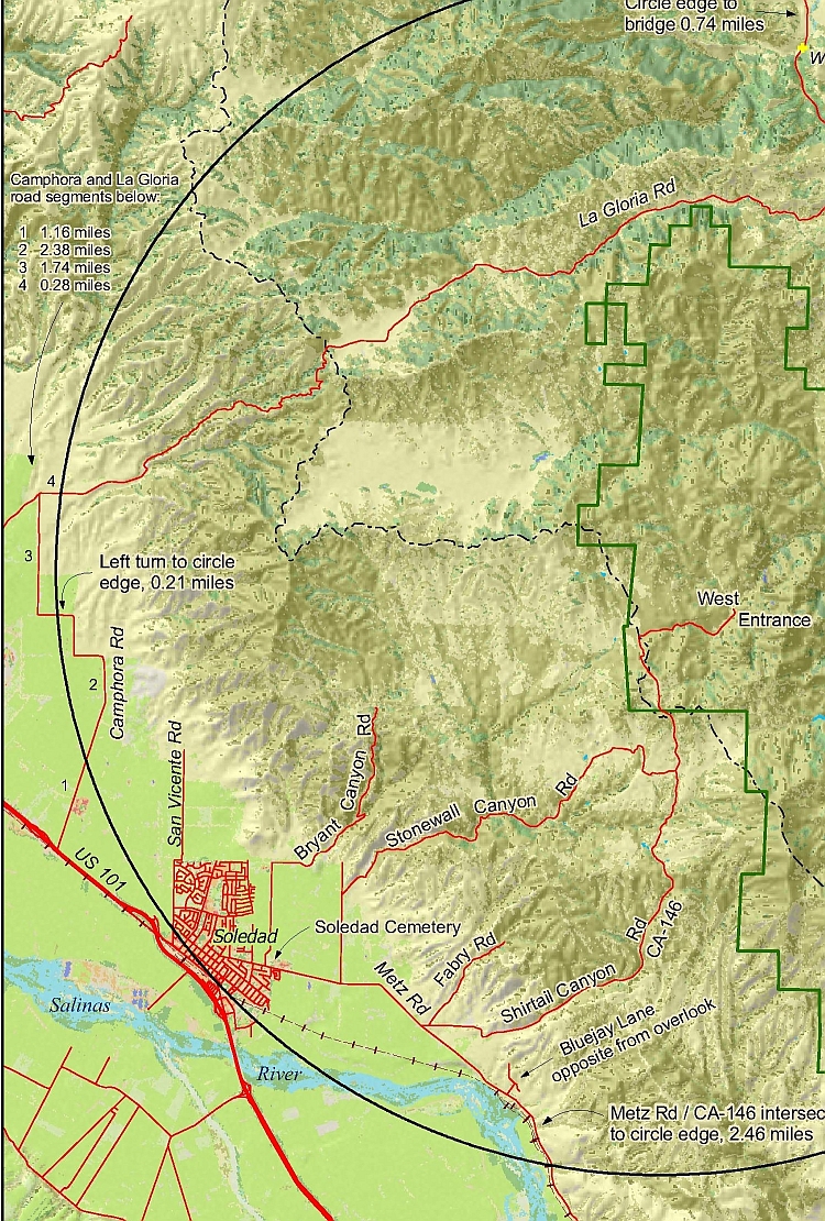
- To download or view a map of the count circle, which includes roads, terrain, vegetation, and landmarks, click here: PinnCBC_Landsat.pdf. This file is 8.3MB in size, so will take a few minutes to download (but it's worth it). Here is a lower resolution version of the map (2.4MB). Thanks to Rusty Scalf for his hard work in making this map.
- If you don't want to download the big map above, here are two small maps of the partial count circle.
- Count circle, west side (jpeg) (873KB)
- Count circle, west side (pdf) (419KB)
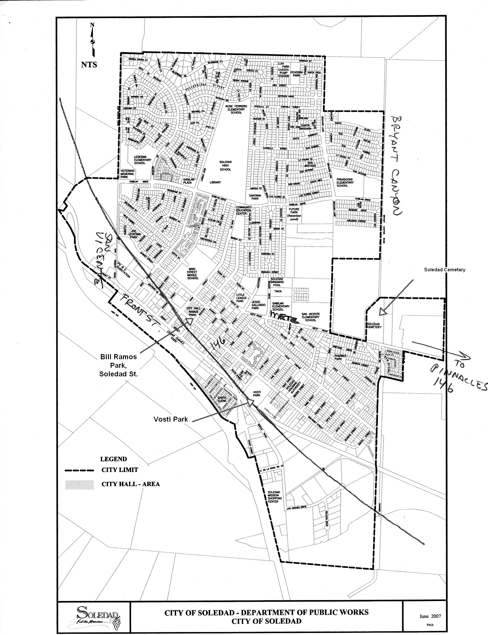
- Count circle, east side (jpeg) (266KB)
- Count circle, east side (pdf) (121KB)
Other Links: Here are some links that you might find helpful.
- The count circle on Google Earth. This kmz file will open Google Earth and overlay the count circle on it. Requires the free Google Earth software.
- A link to the official NPS Pinnacles National Park site.
- A link to the NPS map site for Pinnacles, where you can download several different maps for the park.
- A link to the Christmas bird count site at National Audubon.
- A link to Nature Ali's site for a list of all California CBC's.
Count Results
2012 count results (includes entire count history)
Area count sheet, 2010
Area count sheet 2009